


Heavy rainfall is forecast over north-eastern New South Wales today and into Monday morning, NSW SES advises.
The advice, as of 11am Sunday, said Ex-Tropical Cyclone Alfred is continuing to weaken as it moves further inland on Sunday.
However, heavy rainfall is still possible over parts of the northern rivers, northern tablelands an mid-north coast on Sunday and extending into the north-west slopes and plains Monday, before easing Monday afternoon.
Heavy rainfall which may lead to flash flooding is possible on Sunday about parts of the northern rivers, mid-north coast and eastern parts of the northern tablelands extending into the north-west slopes and plains after midnight and throughout Monday morning.
Six-hourly rainfall totals between 50 and 100 mm are possible.


24-hourly rainfall totals between 100 and 150 mm are possible.
Heavy rainfall is forecast to ease during Monday afternoon.
The risk of damaging wind gusts has eased throughout the warning area.
A Flood Watch and Flood Warnings are current for New South Wales.
For these, please refer to: http://www.bom.gov.au/australia/warnings/

Locations which may be affected include Lismore, Armidale, Tenterfield, Tamworth, Gunnedah, Moree, Narrabri, Casino and Kyogle.
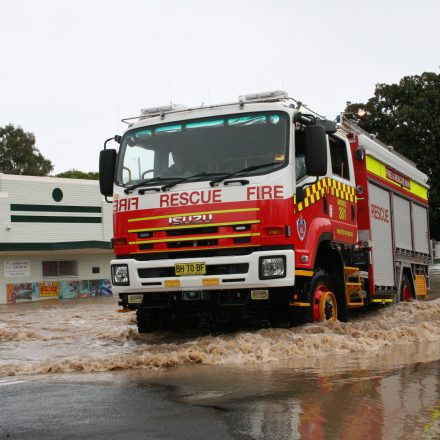
The State Emergency Service advises that people should not drive, ride or walk through flood water and keep clear of creeks and storm drains.
If trapped by flash flooding, seek refuge in the highest available place and ring 000 if necessary.
Be aware that run-off from rainfall in fire-affected areas may behave differently and be more rapid. It may also contain debris such as ash, soil, trees and rocks.
After bushfires, heavy rain and the loss of foliage can make the ground soft and heavy, leading to a greater chance of landslides.


Stay vigilant and monitor conditions. Note the landscape may have changed following bushfires.
For emergency help in floods and storms, ring your local SES Unit on 132 500.
A Flood Watch is current in Queensland for the Macintyre River.
Dangerous flash flooding is possible. Areas at risk will continue to be revised during the coming days.
Flood Classes (minor, moderate, major) are only defined for catchments where the Bureau provides a flood warning service.
For the latest flood and weather warnings see www.bom.gov.au/nsw/warnings/
For the latest rainfall and weather forecasts see www.bom.gov.au/australia/meteye/
For the latest rainfall and river level information see www.bom.gov.au/nsw/flood
Flood Safety Advice:
This Flood Watch means that people living or working along rivers and streams must monitor the latest weather forecasts and warnings and be ready to move to higher ground should flooding develop.
Flood Warnings will be issued if Minor Flood Level is expected to be exceeded at key sites along the main rivers for which the Bureau of Meteorology provides a flood warning service.
Severe Weather Warnings will be issued or updated if very heavy rain is forecast or observed.
For more information on the Flood Watch Service: http://www.bom.gov.au/water/floods/floodWarningServices.shtml
FloodSafe advice is available at www.ses.nsw.gov.au
For emergency assistance call the SES on telephone number 132 500.
For life threatening emergencies, call 000 immediately.


0 Comments