


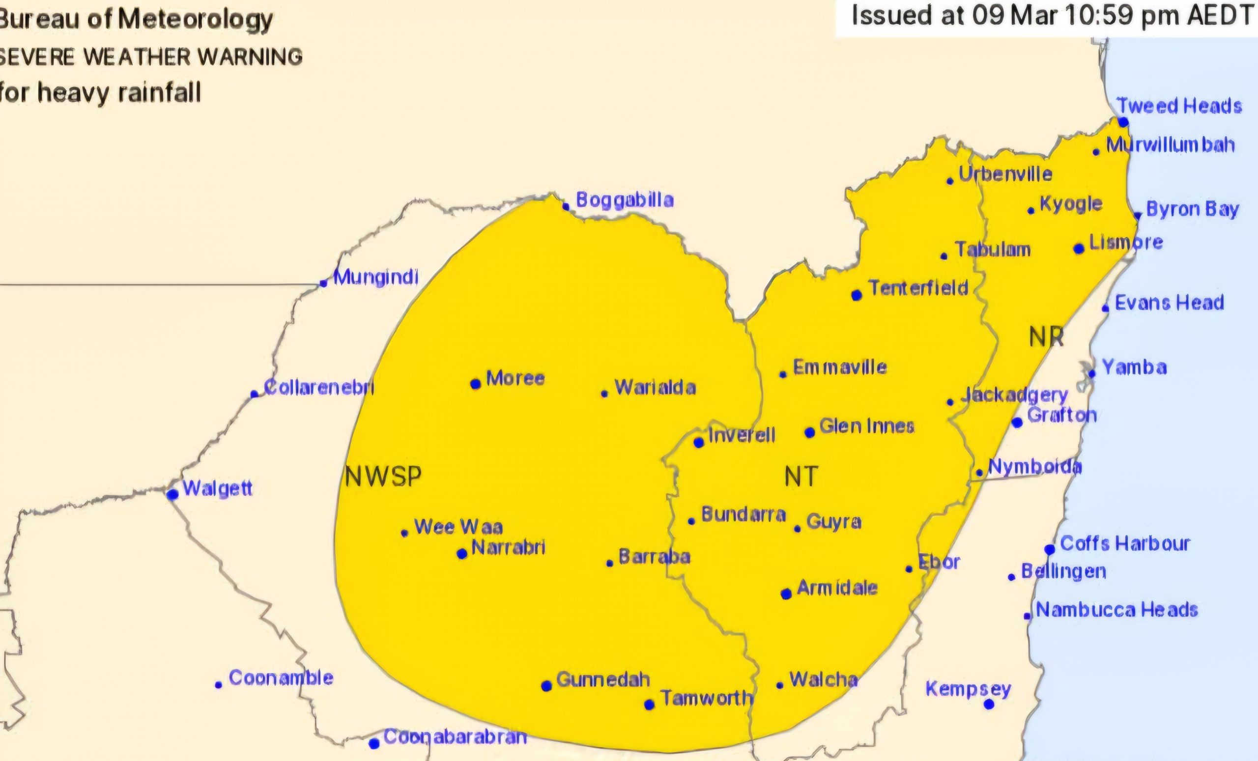
HEAVY rain is forecast over north-eastern New South Wales into Monday morning, extending to the north-west slopes and plains, before easing Monday afternoon.
Locations in the north-west and New England region which may be affected include Moree, Boggabilla, Narrabri, Armidale, Tamworth and Gunnedah.
Ex-Tropical Cyclone Alfred made landfall over the southeast Queensland coastline on Saturday night and is weakening as it moves further inland.
Heavy rainfall is possible over parts of the northern rivers, northern tablelands and mid-north coast, extending into the north-west slopes and plains Monday, before easing Monday afternoon.
Six-hourly rainfall totals between 50 and 100 mm are possible.


24-hourly rainfall totals between 100 and 150 mm are possible, reaching 150 to 200 mm about the border ranges.
Heavy rainfall is forecast to ease during Monday afternoon.
Flood Watch and Flood Warnings are current for New South Wales.
Some big falls have been recorded since 9am Sunday, with Brisbane City copping 270mm of rain in less than 24 hours.
Murwillumbah has received nearly 200mm for the same period.
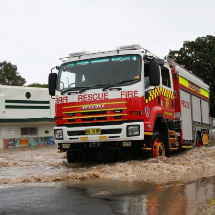
Meanwhile, Fire and Rescue NSW teams deployed in the state’s north continue to support the SES-led emergency response to Ex-Tropical Cyclone Alfred.
Water rescues have been conducted near Bellingen, with residents saved from areas and vehicles isolated by floodwaters.
FRNSW crews are also conducting exercises to improve operational readiness and area familiarisation.
Remotely Piloted Aircraft Systems or drones on standby in Coraki are capable of carrying loads of up to 40kg, which firefighters have been putting to the test with life jacket drop drills.
For the latest flood and weather warnings see www.bom.gov.au/nsw/warnings/


For the latest rainfall and weather forecasts see www.bom.gov.au/australia/meteye/
For the latest rainfall and river level information see www.bom.gov.au/nsw/flood
Flood Safety Advice:
This Flood Watch means that people living or working along rivers and streams must monitor the latest weather forecasts and warnings and be ready to move to higher ground should flooding develop.
Flood Warnings will be issued if Minor Flood Level is expected to be exceeded at key sites along the main rivers for which the Bureau of Meteorology provides a flood warning service.
Severe Weather Warnings will be issued or updated if very heavy rain is forecast or observed.
For more information on the Flood Watch Service: http://www.bom.gov.au/water/floods/floodWarningServices.shtml
FloodSafe advice is available at www.ses.nsw.gov.au
For emergency assistance call the SES on telephone number 132 500
For life threatening emergencies, call 000 immediately


0 Comments