


THE NSW State Emergency Service is monitoring rainfalls across northern New South Wales, and responding to major flood warnings in western communities as floodwater and rain from Queensland moves south.
High clearance Vehicles have been repositioned in Moree Lismore, Grafton and Bourke, and air assets have been deployed to Bourke, Lightning Ridge, Moree, Narrabri, Grafton and Casino.
Up to mid-morning Wednesday, there’s been reports of up to 100mm of rain in Moree and district.
The Bureau of Meteorology’s briefing at 1pm, Wednesday, said minor flooding was likely at Gravesend, Pallamallawa, and Yarraman from early Wednesday afternoon.
At midday, Wednesday, the Gwydir River at Gravesend Road Bridge was 2.89m and may possibly reach the 6.1m minor flood level overnight Wednesday into Thursday.


The Gwydir River at Pallamallawa at midday, Wednesday was 2.16m and rising, and may possibly reach the 6m minor flood level Wednesday evening.
Further rises are possible with forecast rainfall.
The Gwydir River at Yarraman Bridge at midday, Wednesday was 1.98m and rising, and may possibly reach the 4m minor flood level late Wednesday afternoon.
NSW SES assistant commissioner Colin Malone said localised river level rises, and flash flooding was likely within the areas of heaviest rainfall.
“NSW SES issued flood warnings over the weekend for north coast rivers, and warnings could escalate as catchments are wet and responding quickly to rain,” Mr Malone said.
“We don’t want communities to become complacent and are urging people to not drive through floodwaters.”
Meanwhile, moderate to major flooding is likely on the Paroo and Warrego Rivers, similar to levels seen during the 1990 and 2010 floods.
More than 300 people in Wanaaring, Hungerford, Yantabulla, Fords Bridge, Gumbalie and Enngonia could be impacted by ongoing isolations of up to six weeks if major flooding occurs.
Mr Malone said the NSW SES was well-resourced to respond to the long-term flooding in western New South Wales and has air assets in place to assist communities for resupply and rescues if required.
“Flood waters are slow moving in western catchments and flooding is expected to remain at moderate to major levels for some time as floodwater moves into the Darling Basin system. This will isolate communities for extended periods while flooding peaks and then recedes,” he said.
“SES teams and assets have been pre-positioned throughout high-risk locations, and we’re assisted by our emergency service partners from Marine Rescue, Surf Life Saving NSW, NSW Ambulance, NSW Rural Fire Service and Fire and Rescue NSW.”


Flood Safety Advice:
In life threatening emergencies, call 000 (triple zero) immediately. If you require rescue, assistance to evacuate or other emergency help, ring NSW SES on 132 500;
Avoid drowning. Stay out of rising water, seek refuge in the highest available place;
Prevent damage to your vehicle. Move it under cover, away from areas likely to flood;
Avoid being swept away. Stay out of fast-flowing creeks and storm drains; or
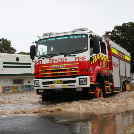
Never drive, ride or walk through flood water. Flood water can be deceptive and dangerous.
For more emergency information, advice, and access to the latest river heights and rainfall observations and forecasts:
NSW SES: www.ses.nsw.gov.au
RMS Live Traffic: www.livetraffic.com
Latest River Heights and Rainfall Observations: www.bom.gov.au/nsw/flood/northwest.shtml
Latest NSW Warnings: www.bom.gov.au/nsw/warnings/
Rainfall Forecasts: www.bom.gov.au/australia/meteye/
BOM NSW Twitter: www.twitter.com/BOM_NSW
IF IT’S FLOODED, FORGET IT!


0 Comments