


THE Australian Bureau of Meteorology forecasts widespread rain over much of north-western New South Wales this week, with good falls likely Tuesday, Wednesday and Thursday to officially close autumn.
BoM meteorologist Jonathan How said a broad area of low pressure will develop over south-east Australia, leading to patchy rain and isolated thunderstorms.
“Widespread rain is forecast over south-east and eastern Australia into this week. However, a range of scenarios is still possible,” Mr How said.
BoM says a cold front will bring showers and isolated thunderstorms to Adelaide, moving into south-east South Australia, Victoria and inland New South Wales.
“Into Monday, a trough and area of low pressure will drag tropical moisture from the north and develop an extensive rain band,” Mr How said.


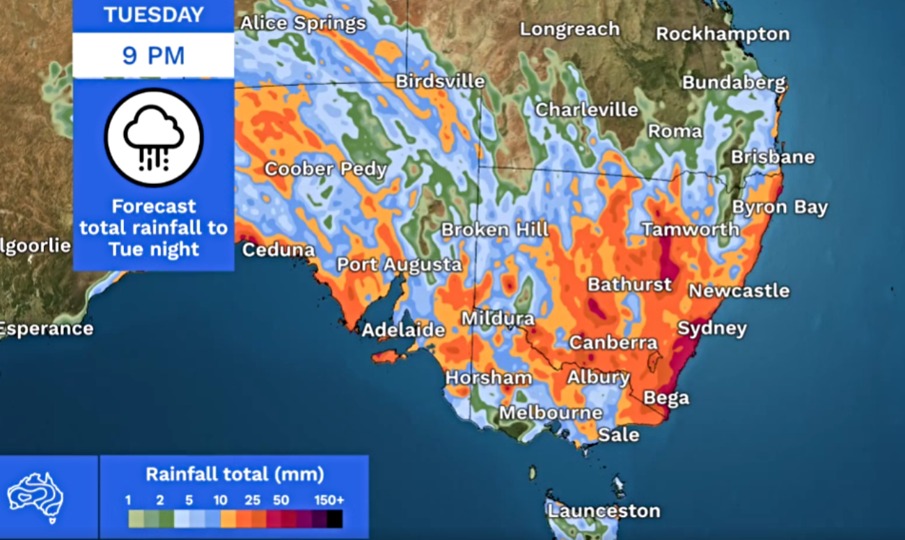
“The movement of the trough will determine which areas receive rain into Tuesday. At this stage, eastern New South Wales and eastern Victoria may see moderate rainfall totals.”
Into the second half of this week, BoM says the rain band will move over the east coast.
Different computer weather models, which help predict the weather, are showing a range of rainfall possibilities for the 5 days between Sunday and Thursday night.
BoM says while most areas will see some rain, there are still differences as to where the highest totals will be.
The Australian (ACCESS) and European (EC) models agree on moderate to heavy rainfall over northern New South Wales and southern inland Queensland. Some of these areas could see localised flooding.
Much-needed rain is expected for the Moree district, with some independent forecasters predicting more than 50mm Wednesday and Thursday this week.
Forecasts vary, however falls of between 25mm and 60mm are being widely predicted, with heaviest falls expected Wednesday and Thursday.
Daily BoM video weather reports are available on the Moree Online News HOMEPAGE, and are generally updated around 3pm each day.


0 Comments