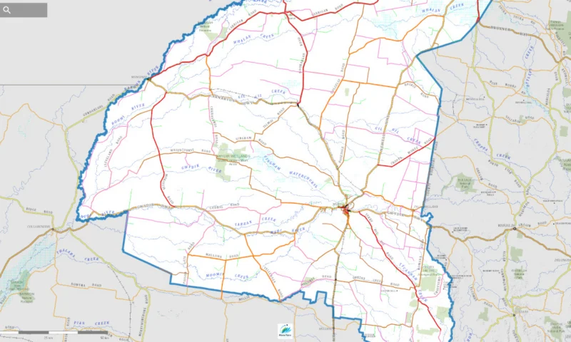
View the Draft Roads Hierarchy Pozi map.
Council’s draft road hierarchy is now open for feedback, with residents asked to check whether roads they rely on have been placed in the right group.
If your road is used by school buses, trucks, farm vehicles or emergency services, now is the time to check how it has been ranked by Council.
Moree Plains residents have until 5pm on Thursday, July 16 to review Council’s Draft Roads Hierarchy, which sorts public roads across the shire into different groups.
Council says each group gives a road a priority level based on its role in the wider network. That level will be used with safety and risk checks when Council decides how to respond to road issues, including grading, resheeting, renewal and upgrades.
A road used mainly for property access may be ranked differently from one used as a school bus route, freight link, emergency access road or district connection.
That is why residents are being asked to check whether the proposed ranking reflects how their road is actually used.
Council is responsible for 2,782 kilometres of local roads, including 916 kilometres of sealed roads and 1,866 kilometres of unsealed roads.
The six draft groups
The Draft Roads Hierarchy sorts public roads into six groups:
- State Road: roads operated by Transport for NSW.
- Arterial Road: major links between council areas, towns, regions or key local centres.
- Primary Collector Road: roads linking major routes to the local road network.
- Local Collector Road: roads linking local roads to the Primary Collector network.
- Local Road: roads connecting smaller access roads to collector roads.
- Local Access Road: roads mainly used to reach individual properties.
Council says the Pozi map is the best way to view road sections and the wider network.
Residents can view the Draft Roads Hierarchy Pozi map here: https://moree-public.pozi.com/#/x[149.58121]/y[-29.32434]/z[10]/layers[draftroadhierarchy2026]/layers[highway]/layers[nswglobe]/
Residents who believe a road is in the wrong group can comment through the online feedback form here: https://forms.office.com/pages/responsepage.aspx?id=YwbZy3t7OUuYaMbX9Lk4WPMoW2sZCmdEqMaTAfSfUb5UMDFIRkU1UFVOOFFRTDE2U0c3NVNRMENYUy4u&route=shorturl
That may include roads they think should be ranked differently because of how they are used, such as for farm access, freight, school buses, emergency access, flood isolation, village links, local facilities or regular through traffic.
A road list is also available through the online feedback form.
Submissions close at 5pm on Thursday, July 16.
Residents can also contact Council’s Infrastructure team on (02) 6757 3222.